• The River
    • Eagles along the Hoosic
    • Meet the Hoosic
    • The Natural Community
    • The Watershed
      • Virtual Tour
  • About Us
    • Strategic Plan
    • History
    • Volunteers
  • Projects
    • Issues/Concerns
    • Videos
  • Recreation
    • Biking the Hoosic
    • Hiking the Hoosic Watershed
    • Paddling the Hoosic
    • Fishing In the Hoosic
    • River Flow Info
  • Advocacy
    • Reducing NPS Pollution
    • Remediation Projects
    • Restoring and Protecting Habitat
    • River and Trail Access
    • Sound Land Use
  • Calendar
  • Join/Renew/Donate
  • Blog
    • Facebook

Hoosic River Watershed Association

Low water levels

in News on 02/08/16

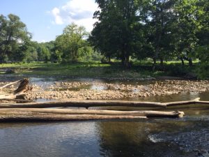
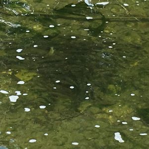
Recent rains have helped to raise the water levels in the Hoosic and its tributaries.  Low water levels in July meant fish in the river went to deeper pools for cooler water and more oxygen.   Here are photos of low water in Williamstown and trout pooling in a nearby tributary.


Low water at Lauren's LaunchTrout in Little Hoosic pool

« The Mahican-Mohawk Trail
Spring 2020 Water Quality Testing on the Hoosic in North Adams »
Paddling between North Adams and Pownal is usuallly safest when the Williamstown gauge reads 200cfs - 700cfs.

Water Level


Click on graph to enlarge.
Use your judgment before leaving, if the river feels too dangerous for you, postpone your trip.

Upcoming Events

There are no upcoming events.

View Calendar
Add
  • Add to Timely Calendar
  • Add to Google
  • Add to Outlook
  • Add to Apple Calendar
  • Add to other calendar
  • Export to XML

Sign up for our mailing list

Archive

Past Newsletters

Recent Posts

  • Trees Can Help Mitigate Climate Instability
  • Recording of Glasgow on the Hoosic: The Climate Crisis after COP26

Contact Us


906 Main St, Williamstown, MA 01267 /
PO Box 667
(413) 458-2742
office@hoorwa.org

Copyright © 2022 · Website by Brainspiral

Copyright © 2022 · HooRWA 3 on Genesis Framework · WordPress · Log in