Stewards of the Land & Waterways
It is with gratitude and humility that we acknowledge that we are learning, speaking and gathering on the ancestral homelands of the Muhheaconneok who are the indigenous peoples of this land. Despite tremendous hardship in being forced from here, today their community resides in Wisconsin and is known as the Stockbridge-Munsee Community. We pay honor and respect to their ancestors, to the Community, and those who continue to return to their homelands, as we commit to nurturing a more inclusive and equitable space for all. To learn more about the Stockbridge-Munsee Community and their work in their tribal homelands, visit www.mohican.com.
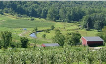
Because the Hoosic Valley is still relatively undeveloped, we still have a chance to guide development wisely — and protect what should be protected before it is gone. It’s up to the residents of the watershed to be proactive in guarding the health and beauty of their region.

What you can do.
- Learn about the benefits of open space. It’s more than a pretty view!
- Participate in town or city planning.
- Support local land trusts.
- Consider conservation easements or the sale of development rights on your property.
- Support and collaborate with the original stewards of the region. Visit the Stockbridge-Munsee Community for more information.
Resources