HooRWA is dedicated and very active in the protection of the Hoosic Watershed.
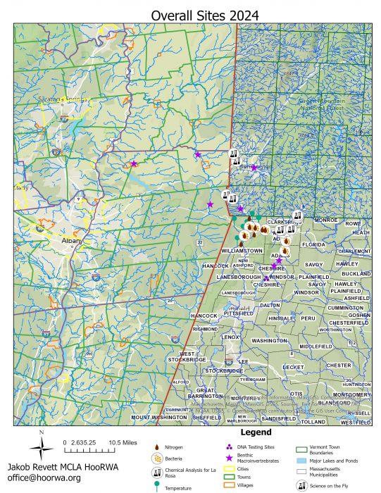
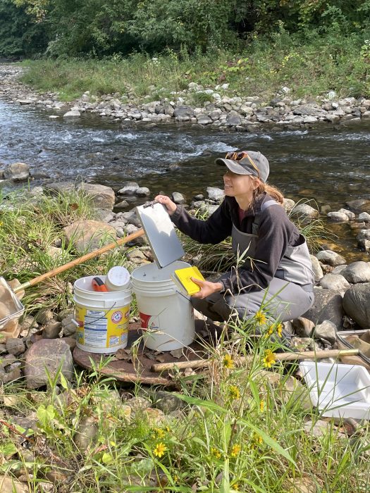
- Our 2024 water quality monitoring work includes sampling for bacteria, DNA, chloride, nitrate, phosphorous, and temperature. And we’re grateful to our interns for helping us carry out this work! We added 5 sites to our bacteria monitoring, specifically in the North Adams’ flood chutes, and yes, some of those sites are showing high E.coli counts. Our data has been submitted to MA DEP for inclusion in their next report. Our initial DNA testing in the Hoosic showed that yes, it’s human fecal matter entering the River, not fowl or farm animals. Check out where HooRWA was in the Watershed in 2024 conducting water quality monitoring on our interactive map. Many thanks for MCLA summer inter Jakob Revett for setting this up for us.
- HooRWA entered into a new contract with Cole Ecological, Inc. in 2024 after Watershed Assessments Associates retired from field work. They provided HooRWA with the familiar-looking Report Card and a comprehensive report. Check them out!
- Review Berkshire Surface Water Quality Monitoring Map of the Hoosic River and Housatonic River watersheds. This map is updated annually and is maintained by our partners at Berkshire Environmental Action Team (BEAT). HooRWA, Housatonic Valley Association (HVA), and BEAT all input our water quality monitoring data to generate this map. You can see 2024 and 2023 e.coli levels data. We have submitted our 2024 e.coli data to MA DEP for inclusion in their next report.
- The Hoosic River Watershed Association has been collecting stream temperature data in the Hoosic River Watershed since 1999, with the objective of better understanding the conditions that make the Hoosic a cold-water fishery. We monitor stream temperature to assess how cold the water stays in the face of warming trends. Generally, tributaries contribute cooler waters to the next higher order river segment they connect to. This summer several tributaries reached above 68 degrees, a marker for stressing native Brook Trout among other fish. As we watched water temperatures rise we put out alerts on social media to please not fish so as to not stress them more and give them a fighting chance. If you live along a streambank, consider what you can do to help keep that stream cool: plant native trees to a) stabilize the riverbank against erosion and b) shade both the bank and the stream to create a cooling effect. Read HooRWA’s 2024 Temperature Report. Our data has been submitted to MA DEP for inclusion in their next State Report. Review Wing Brook’s summer temperatures.
2023’s Water Quality Monitoring Wok and Reports
- Review HooRWA’s 2023 Water Quality Monitoring summary of work.
- Read the more detailed report of our Stream Temperatures Sampling in the Hoosic Watershed in 2023
- Read HooRWA 2023 Report Card on the River’s health using benthic macroinvertebrate sampling: HooRWA Hoosic River Report Card 2023
- Review VT DEC LaRosa Partnership Water Quality Monitoring Map. The 4 sites HooRWA is sampling are in purple in the southwest part of VT. Also, LaRosa’s 2023 Water Quality Monitoring data is available to review. Check out HooRWA’s sites. Choose “Hoosic River Watershed Association” as “Partner to view data for chemical analysis.
2022 Water Quality Monitoring Work and Reports
- Read HooRWA 2022 Report Card on the River’s health: HooRWA Hoosic River ReportCard2022
- Read Stream Temperatures in Hudson Brook Summer 2022 summary by Richard Schlesinger and the accompanying chart. Additionally, read the 2021 stream temperature report HERE and the 2020 stream temperature report HERE.
Review older work:
- Read HooRWA 2021 Report Card on the River’s health: HooRWA Hoosic River ReportCard2021
- Read Hoosic River Watershed Updated Water Quality And Aquatic Habitat Assessment December 2014
- The Hoosic River is part of the Hudson River Watershed. Review MA DEP’s 2002 and 1997 Water Quality Assessment Reports.
What HooRWA does.
Besides riverbank cleanups, HooRWA identifies other areas of concern along the river. We do not fund or conduct large-scale remediation ourselves, but can help landowners and townships seek technical assistance or funding.
What you can do.
Bring unknown dump sites to our attention.
Volunteer on river cleanup days.
“Non-point-source” or NPS pollution is pollution that cannot be traced to a single-source outfall such as a factory pipe discharging into the river. Examples of non-point-source pollution include stormwater runoff from lawns, roads, parking lots, building sites, and agricultural fields. This runoff can contain petroleum products, salt, animal waste, fertilizers, pesticides, heavy loads of sand and silt, or other contaminants. Failing septic systems or other contamination of groundwater can also contribute to NPS pollution.
Since the Clean Water Act went into effect, most point-sources of pollution have been identified and regulated. Their contribution to river pollution has decreased dramatically. NPS pollution is a much harder problem to solve, because the solution depends on individuals deciding to change the way they do things.
- Spare your local storm drain!
What goes into a storm drain may straight into a river, or may enter a river via a sewage treatment plant. EITHER WAY, most pollutants are not removed! To reduce the strain on storm drains…
-
- Avoid dumping soaps, oils, solvents, etc. in the driveway.
- Reduce or skip the use of herbicides, pesticides, or fertilizers on the lawn, especially before rain.
- Scoop your dog’s waste from the street or hard surfaces.
Let gutter outflow soak into the ground, or collect it in rain barrels.
- Keep the septic tank in good working order
- Fence pastures so that livestock don’t wade in the river.
- Allow a buffer zone of vegetation to grow up between an open field and the river’s edge.
This discourages geese from loitering, too.
For more information on non-point-source pollution, contact us.
Here are a few essentials for good habitat:
- Water that is clean, clear, the right temperature, has enough oxygen, and has reliable flow.
- A river bottom free of toxins or excess sediment.
- Streambanks that are vegetated– but not dominated by invasive plants.
- Passageways for wildlife to move freely up and down stream, in the water and on shore.
- A landscape that can adapt to natural floods and meandering of the riverbed.
What HooRWA does.
HooRWA advocates land management and development practices that maintain or restore good habitat. HooRWA also advocates landscaping practices that can accommodate floodwater without extreme damage to habitat or property.
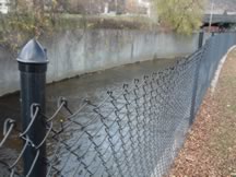
In the upper Hoosic, this is a challenging goal. The hilly terrain dumps rainstorms downhill quickly, sometimes flooding the built-up bottomlands. This is why flood protection chutes were built in Adams and North Adams, MA, in the mid-twentieth century. In the process, habitat was destroyed and the towns lost ready access to the river.
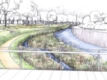
We believe that today, new engineering approaches could maintain flood protection while restoring habitat and attractive riverfront. HooRWA is one of the organizations committed to working toward this goal.
What you can do.
Speak up to town and state officials about funding river restoration and flood chute modifications.
A day of paddling, fishing, or hiking brings home a river’s value better than all the data in the world. HooRWA has a long history of improving river access points and hiking trails for low-impact recreational uses–because the river speaks to those who visit it.
What you can do.
- Try the river and trails! Our Recreation page can help.
- Volunteer for trail maintenance or river cleanups.
- If you are a landowner, consider granting rights-of-way for boaters or hikers.
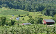
Because the Hoosic Valley is still relatively undeveloped, we still have a chance to guide development wisely — and protect what should be protected before it is gone. It’s up to the residents of the watershed to be proactive in guarding the health and beauty of their region.
What you can do.
- Learn about the benefits of open space. It’s more than a pretty view!
- Participate in town or city planning.
- Support local land trusts.
- Consider conservation easements or the sale of development rights on your property.

