
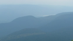
A watershed is the region that drains into a particular body of water such as a river or lake. This is why watersheds are also known as drainage basins. A river’s watershed extends all the way to the tops of the hills and ridges that surround the river valley. A drop of water falling anywhere inside the watershed boundaries will eventually make its way down to the river, either in a stream, or over the ground, or under the ground. Taking care of the river, then, means taking care of the whole area that drains into the river.
Major watersheds are made up of smaller watersheds. The Hoosic River Watershed is made up of all the streams, brooks, and smaller rivers that feed into the Hoosic River. And the Hoosic River is part of the Hudson River Watershed, which empties into the Atlantic Ocean.

20 communities across 3 states, tethered together by topography.
The Hoosic is a three-state river. It is fed by streams that run down from the Green Mountains of Vermont, the Taconics of New York, and the sides of Mount Greylock, the highest peak in Massachusetts (3,491 ft.). It runs 70 miles from where it begins, at the Cheshire Reservoir in Massachusetts in the south and Stamford Vt in the North. The branches meet up in North Adams in the flood chutes and from there flows north and west to where it enters the Hudson river at Stillwater, NY. Altogether, the Hoosic and its tributaries drain 720 square miles of land. The river passes through several towns, but much of the watershed is farmland and forest. Major tributaries are the Hoosic North Branch, the Green River, the Little Hoosic, the Walloomsac, the Owl Kill and the Tomhannock.
Are you a Hoosician? Most people can tell you what city and state they live in, but not what watershed. This is odd, because people who share a watershed affect each other by the ways they treat the land and water. Everyone is upstream or downstream of everyone else. The Hoosic watershed includes these towns:
Massachusetts: Adams, Berkshire, Cheshire, Clarksburg, Hancock, Lanesboro, New Ashford, North Adams, Savoy, Williamstown.
Vermont: Bennington, North Bennington, Pownal, Shaftsbury, Stamford, Woodford.
New York: Berlin, Buskirk, Cambridge, Cropseyville, Eagle Bridge, Grafton, Hoosick, Hoosick Falls, Johnsonville, Middle Falls, North Hoosick, Petersburg, Schaghticoke, Valley Falls.
Parts of the Hoosic Watershed are protected or have some special status. In Massachusetts, 29 miles of the Hoosic have been adopted as a state-designated Local Scenic River. Two tributaries on the west side of Mount Greylock, Hopper and Money Brooks, are state-designated Natural Scenic Rivers. The Trustees of Reservations holds Mt. Greylock and nearby watershed lands in Massachusetts, and the Green Mountain National Forest holds much of the watershed acreage in VT. The Tomhannock Reservoir in New York is also protected, because it is the water supply for the city of Troy.
Ecological Communities of the Hoosic:
- Rivers and their tributaries: Streams and rivers in the watershed range from small headwater brooks that are cold, shallow, shady, and rocky, to the wide, deep, sunlit mainstem of the lower Hoosic. Most living things in the upper streams depend on dead leaves and wood for food, either directly or indirectly. The lower reaches of the river support aquatic plants and a more complex animal community. Trout do best where the water is cold, clean, and well-oxygenated, so the shady, forested tributaries are important to them.
- Lakes, Ponds, Pools, and Wetlands: There are few extensive wetlands (marshes or swamps) in the watershed. There are several lakes, most of them made by damming the Hoosic or its tributaries. These include Cheshire Reservoir in Massachusetts and Tomhannock Reservoir in New York. Beaver ponds are common, as are small vernal pools in the forest. Food chains in the lakes and ponds are based on algae and other aquatic plants; the shady woodland pools depend mostly on dead leaves and wood as a food supply. This variety of watery habitats helps maintain the watershed’s biological diversity.
- Riparian Forest: The riverbank is an ever-changing scene, and the forest that grows there is a special kind of community that can handle a lot of challenges. Riverbank plants are battered by floodwater, floating debris, and ice. They are undermined or buried as the river constantly removes and deposits sediments. But there are good things about riverbank life too. Water, nutrients, and sunlight are fairly abundant, and there is often fresh ground for new seed to grow. As a result, the riparian community is full of plants that excel at colonizing sandbars, or resisting immersion, or transporting their seeds via water, or taking quick advantage of sunny gaps on the riverbank or in the river floodplain. Riparian forest is extremely important as a buffer between the upland and the river. It intercepts stormwater and meltwater runoff, so that sediments and pollutants in the runoff settle out instead of being carried into the river. The forest’s network of roots and other vegetation stabilizes streambanks, preventing erosion and property loss. It also provides habitat and a travel corridor for many river-dependent species such as mink, otter, wood turtles, and wading birds.
- Upland Forest: The Hoosic watershed uplands include both northern mixed hardwood forest and conifer forest, depending on terrain and soil. Even when it is miles uphill from the Hoosic, forest protects the river in many ways. A forest absorbs precipitation and allows it to percolate into the ground, preventing the excess runoff that leads to floods. Forests also help to stabilize soil, especially on slopes, thus preventing erosion. Forests are also critical for keeping tributary streams clean, shaded and cool. Cool, clean tributaries help maintain a cool, clean Hoosic mainstem. The Hoosic’s health starts under the trees at the very top of the watershed!
River History
Read Dispatches from the Beyond Place: Tales of the Hoosic River by Lauren Stevens