Some Facts and Figures
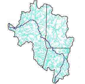
The Hoosic is a three-state river. It is fed by streams that run down from the Green Mountains of Vermont, the Taconics of New York, and the sides of Mount Greylock, the highest peak in Massachusetts (3,491 ft.). It runs 70 miles from where it begins, at the Cheshire Reservoir in Massachusetts, to where it enters the Hudson river at Stillwater, NY. Altogether, the Hoosic and its tributaries drain 720 square miles of land. The river passes through several towns, but much of the watershed is farmland and forest.
Major tributaries are the Hoosic North Branch, the Green River, the Little Hoosic, the Walloomsac, the Owl Kill and the Tomhannock.
Parts of the Hoosic Watershed are protected or have some special status. In Massachusetts, 29 miles of the Hoosic have been adopted as a state-designated Local Scenic River. Two tributaries on the west side of Mount Greylock, Hopper and Money Brooks, are state-designated Natural Scenic Rivers. The Trustees of Reservations holds Mt. Greylock and nearby watershed lands in Massachusetts, and the Green Mountain National Forest holds much of the watershed acreage in VT. The Tomhannock Reservoir in New York is also protected, because it is the water supply for the city of Troy.
